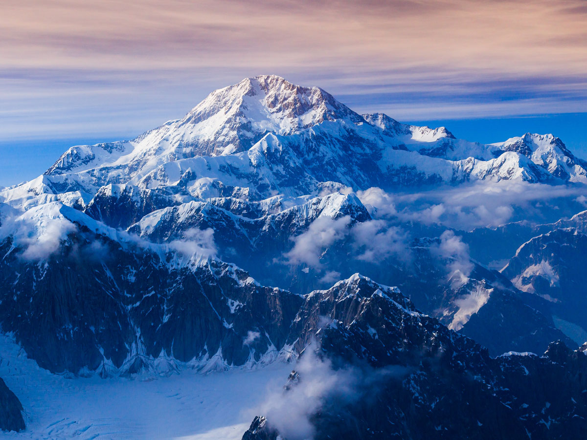
Denali, formerly known as Mount McKinley, is the highest point in the 50 states. At a staggering 20,237 feet above sea level, Denali may be the highest point in the 50 states and North America as a whole, but it is not even one of the 50 tallest mountains in the world.
This peak's national park is both larger than the state of New Jersey and defined by a wilderness that's mostly untouched by humans. On top of it's beautiful wildlife and unmatched camping opportunities, Denali is the third most prominent and third most isolated peak on Earth, after Mount Everest and Aconcagua, where few people dare to test their mountaineering skills.
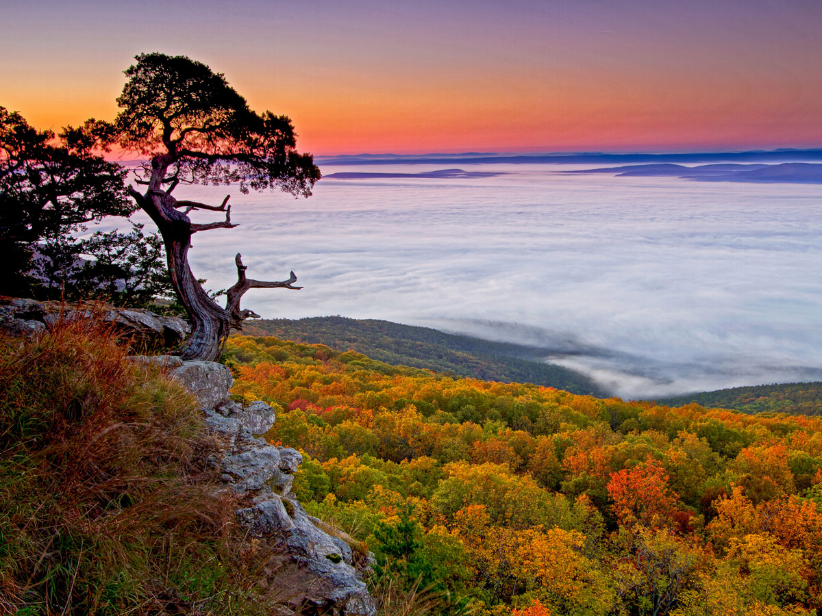
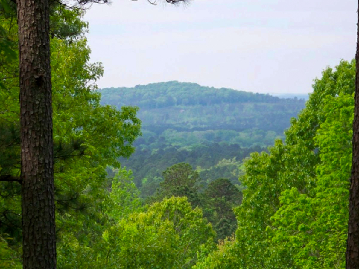
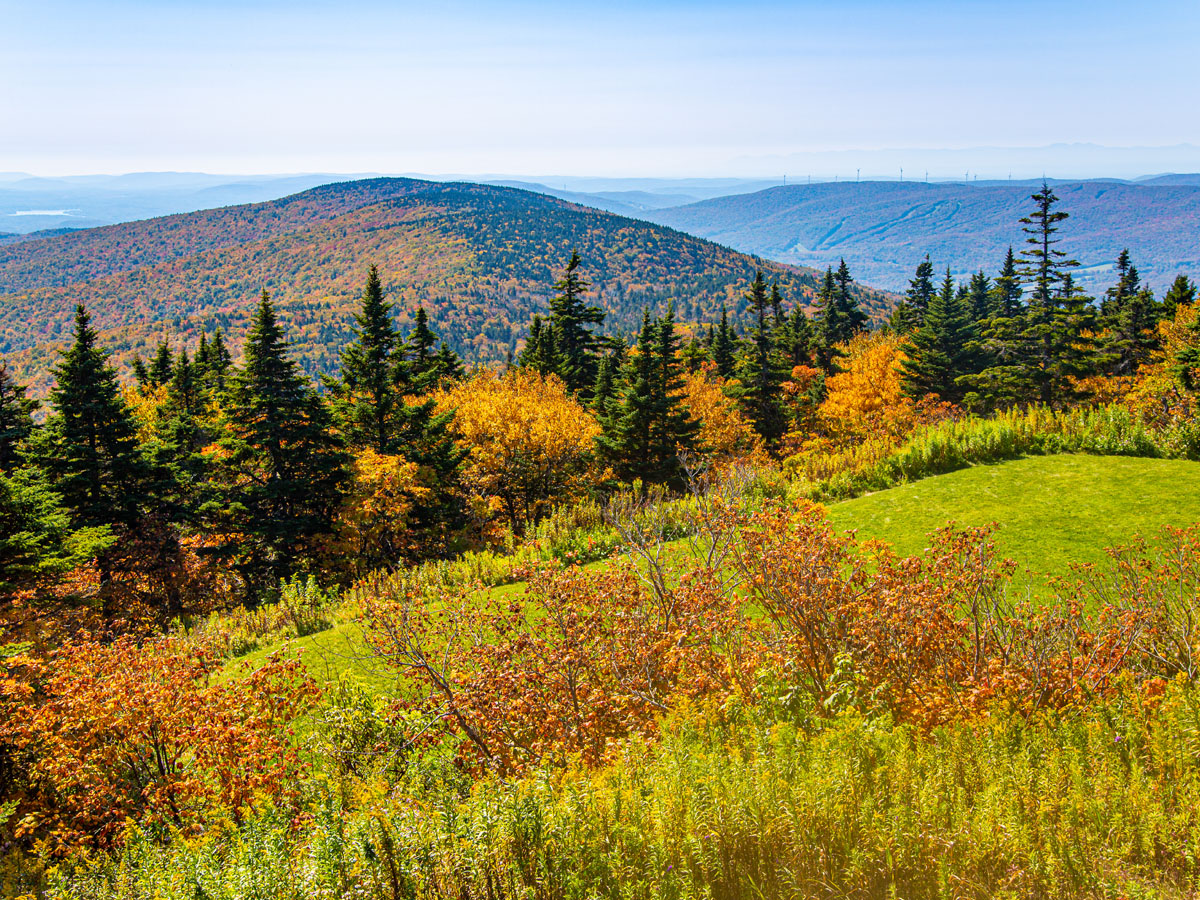
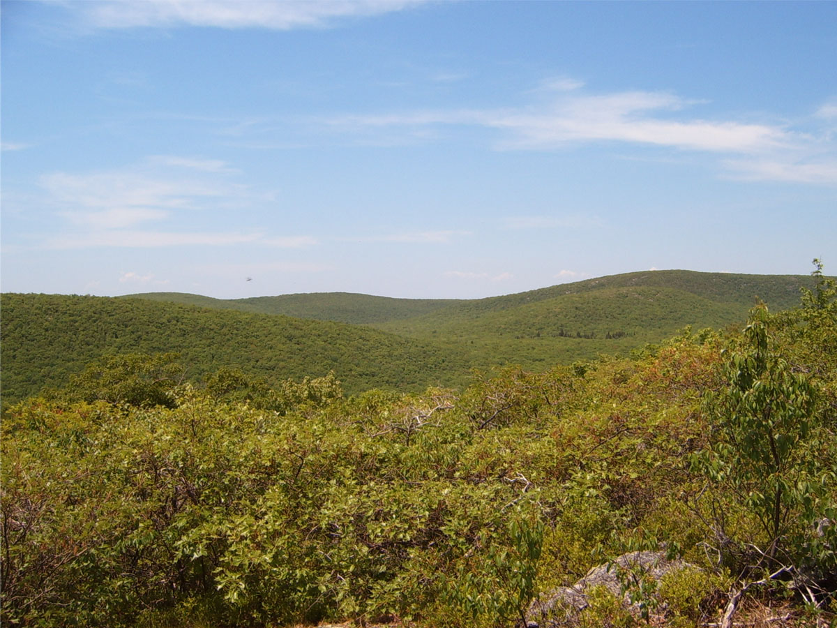
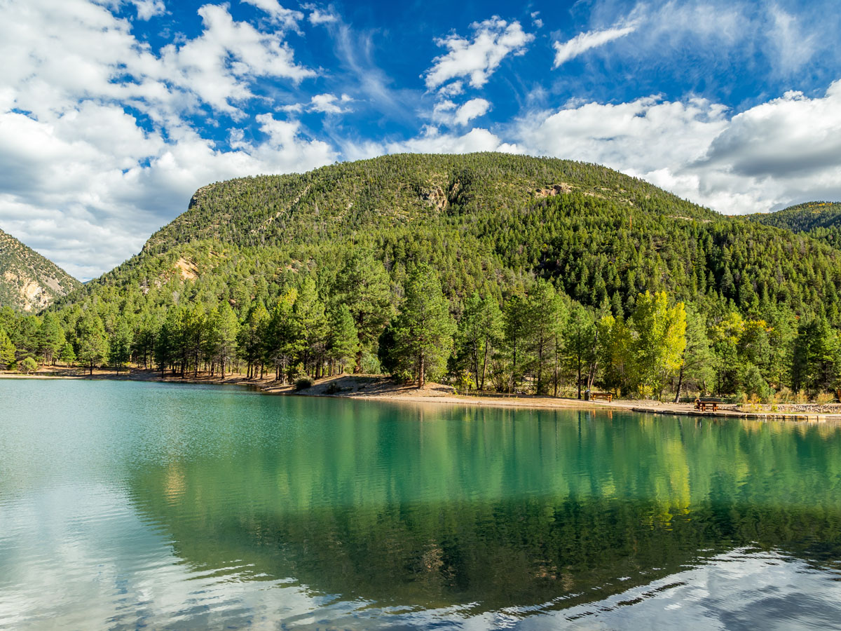
You may not know, but Arkansas actually has quite a few high points because it is part of the Ozark and Ouachita Mountain Ranges. Mount Magazine is located in the Ozark Mountains, although it is also very close to the Ouachita Mountains on the southern side of the Arkansas River Valley.
The associated Mount Magazine State Park is an amazing vacation spot for just about anyone. From honeymoon trips to ceremonies to corporate retreats, the scenic overlook of the Petit Jean River Valley and Blue Mountain Lake make the part a first-class getaway. During your stay, make sure to take advantage of the rock climing, hiking trails, and hang gliding!

If you thought Delaware’s highest point was low, Florida’s is even lower. In the middle of a park there is a monument that may leave you puzzled as to why it is there. Well, it’s the marker for the highest “peak” in Florida on the top of a small hill in a park.
In fact, Britton Hill is barely even a hill. As the lowest state highpoint in the United States 103 feet lower than the second-lowest peak, travelers shouldn't stop at this landmark if you're looking for a day hike or spectacular views. You're better off visiting the Miami skyscrapers for an adventure.
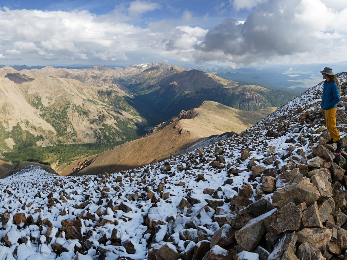
Colorado is known for its peaks because of the Rocky Mountains, but Mount Elbert is the highest of those peaks. It’s fitting that it comes after Mount Whitney in this list because it is the second highest mountain in the contiguous United States. The surrounding Rockies are filled with countless false summits, so know that Mount Elbert is the real deal!
Named after Colorado statesman Samuel Hill Elbert who served from 1873-1874, the mountain is popularly referred to as the "gentle giant" of the Rockies. However, it should still be taken seriously by climbers. The avalanche risk is low, but the fickle weather and high elevation always poses risks to any hiker.
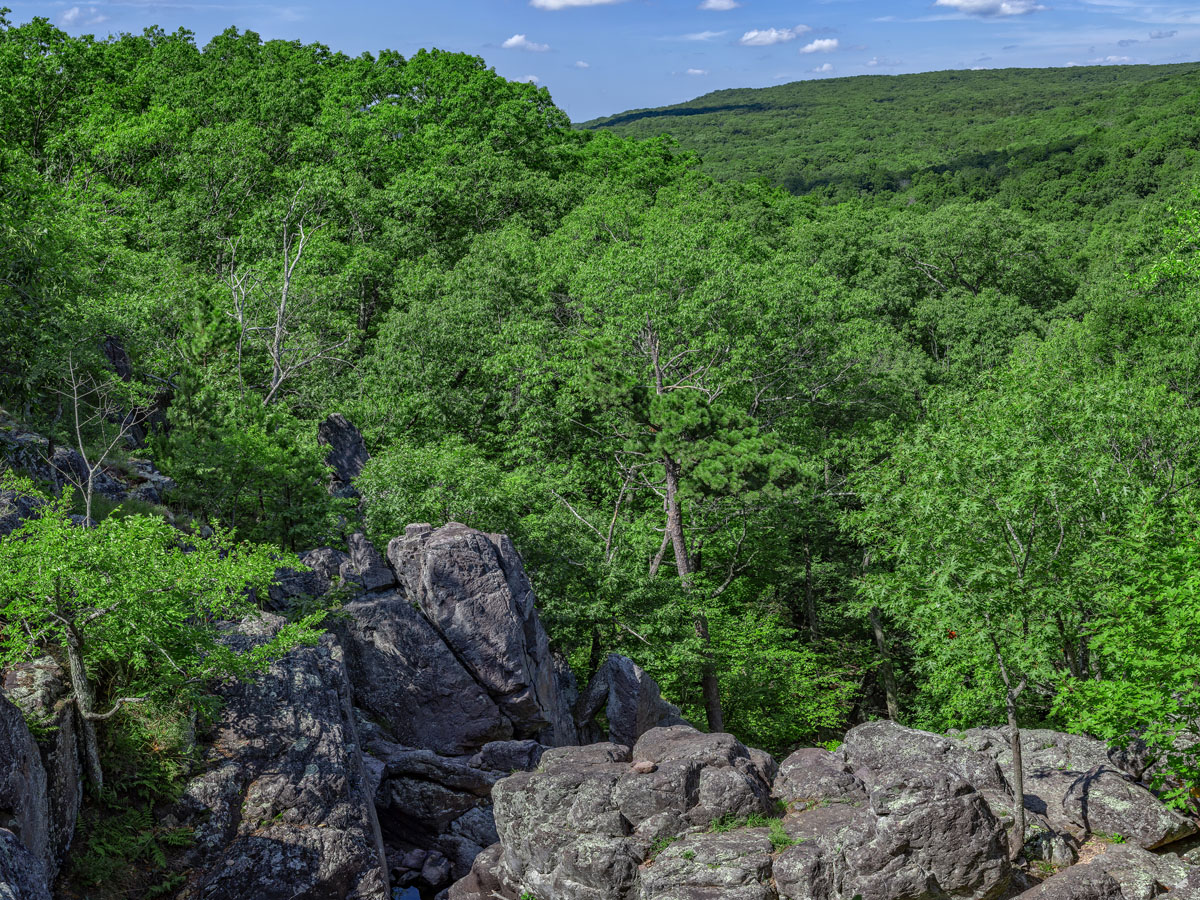
Mount Mitchell is not only the tallest mountain in the Appalachian Mountains, but it is also the tallest mountain east of the Rocky Mountains in Colorado. It is named after Elisha Mitchell, a professor at the University of North Carolina, who studied the mountain and actually died while on a hike on this mountain to verify his measurements.
The mountain was once named Attakulla by the native Cherokee people before European settlers called it the Black Dome due to it's circular shape. The associated Mount Mitchell State Park includes an exhibit hall that points to the mountians' natural, cultural, and historical heritage as well as over eight miles of hiking and walking trials.
The peak of Taum Sauk Mountain as well as the surrounding peaks were said to be some of the only land in that area to not be covered by ancient seas. During the Paleozoic era, it’s possible that these peaks were once solitary islands in the midst of those waters.
Located in the St. Francois Mountains, the park features beautiful hiking, view of the countryside, a rustic campground, a picnic area, a paved trail to the plaque signaling the highpoint, and a lookout tower for a view that pierces the dense forest for a gorgeous view that can't be enjoyed from many other vantage points.
This actual mountain in Georgia is not only the highest peak, but it also comes with a rich history from the Cherokee people. This mountain is part of the Cherokee history that says there was a great flood where only a few Cherokee families survived in a giant canoe and were saved by hitting dry land on this mountain.
At 4,784 feet, Brasstown Bald is a great destination for casual hiking, picnicking, and unmatched gazing at the surrounding Chattahoochee - Oconee National Forest. On the clear days, visitors can catch a glimpse of four surrounding states with the observation deck's 360-degree views of the stunning Southern Appalachian landscape.
Coming in at the tenth highest point in the United States is Granite Peak in Montana. However, it is the second most difficult peak to climb after Denali since the terrain is rough, the weather is often bad, and it requires a lot of technical skill. So good luck with that!
Granite Peak is located in the Absaroka-Beartooth Wilderness in Park County. The first successful ascent of the peak was made by Elers Koch, James C. Whitham, and R.T. Ferguson on August 29, 1923, making it the last state high point to be climbed. The typical climb lasts two-three days, but ambitious climbers take one day. The fact that you traverse the "Froze-to-Death Plateau" signals to all climbers that it's not a journey for the novice hiker.
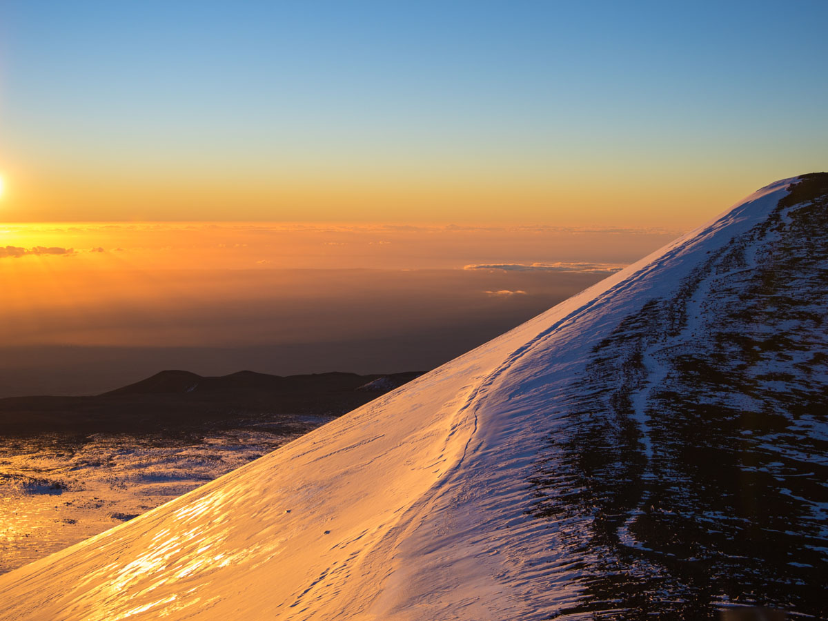
Mauna Kea is a dormant volcano on the island of Hawaii and is the highest point in the state of Hawaii. The over 13,000 foot part of this volcano is only the part above the water. However, the majority of this mountain is underwater. If the underwater part was added to the above water height, then it would be the tallest mountain in the world at 33,500 feet.
When most people think of Hawaii, they think of constantly erupting volcanoes such as the Kilauea Volcano. Mauna Kea, however, is usually overlooked because it's dormant and mainly underwater, but it shouldn't be ignored! The peak is sacred to native Hawaiians because it ties directly to their beliefs of creation as the home of divine deities, ancestors, including the Earth Mother and Sky Father themselves.
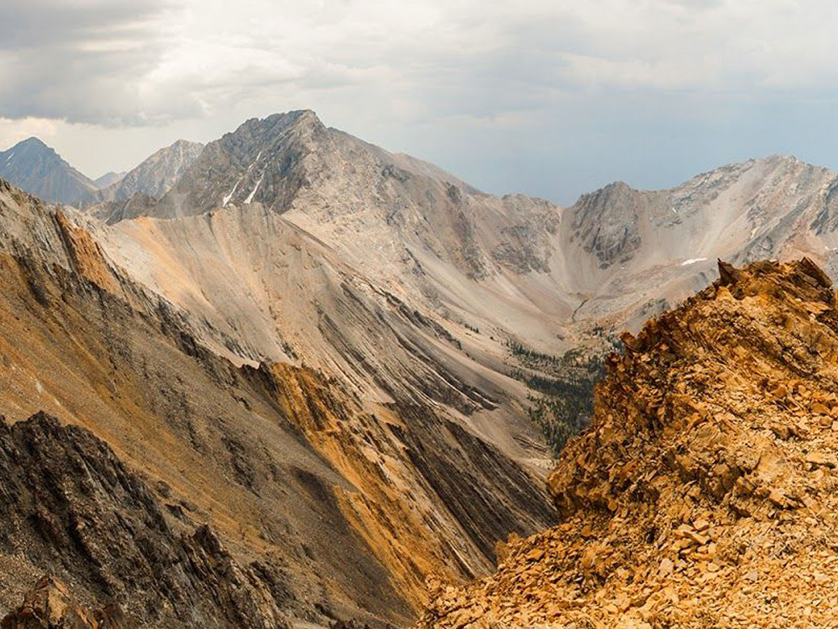
At over 12,000 feet above sea level, Borah Peak is the most prominent and highest peak in Idaho. It’s known for its earthquake that happened in 1983 that caused it to rise one whole foot and the surrounding valley to fall eight feet. Talk about a major tectonic shift!
Also referred to as Beauty Peak, Borah has a lot to live up to. Located in the center of Lost River Range in the Challis National Forest, it was a nameless mountain until it was surveyed and determined taller than Hyndman Peak, which was once considered the tallest in the state.
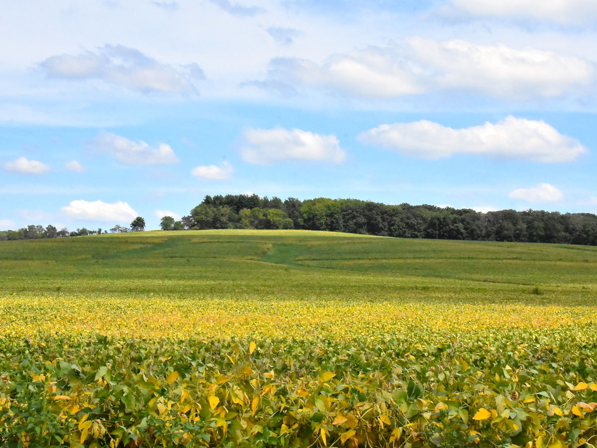
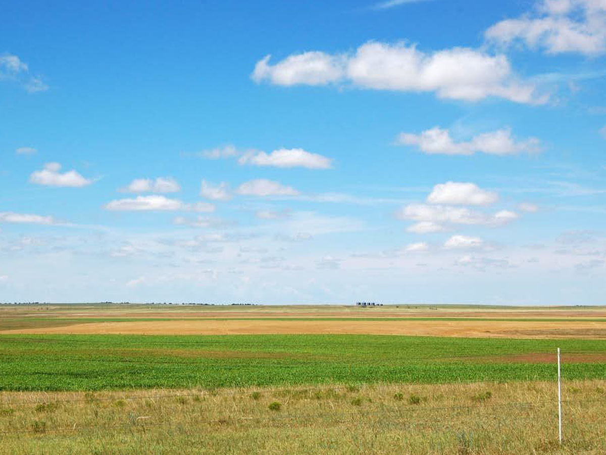
If you’ve ever driven through Illinois, you would know that the topography really doesn’t change much, and that’s very evident in this hill, Charles Mound, that is the highest point in the state. It classifies as a hill because it does not have any sort of sharp drop, and it looks just the same as all of the other farmland around it.
Aside from the questionable name, Charles Mound is open to the public on limited weekends during the first weekend of June, July, August, and September because it is located on private property. There are no exceptions to these dates, but if you're so inclined on visiting when they're open, make sure to take a state mug to help the owners' growing collection!
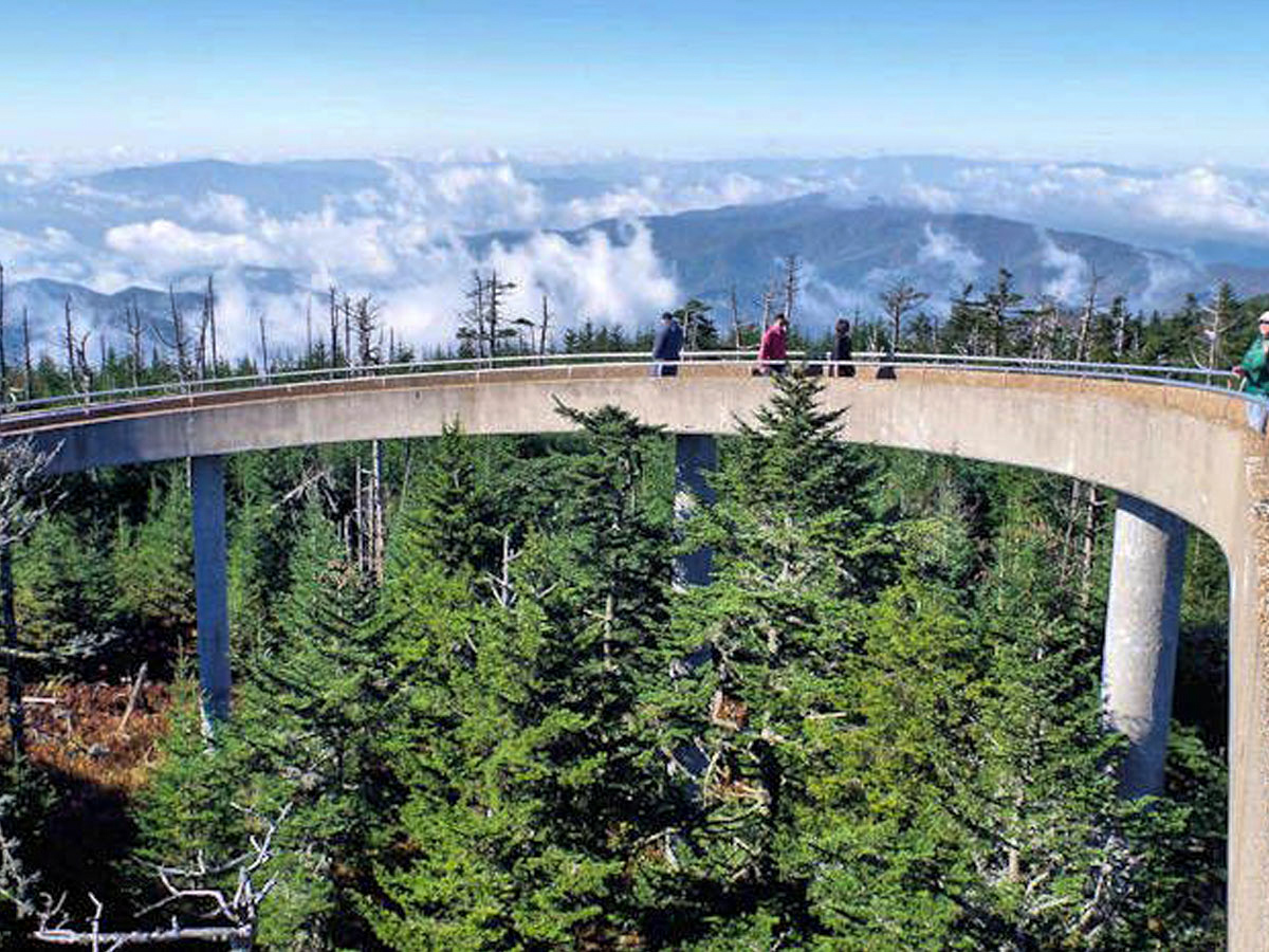
Clingman’s Dome is not only the tallest point in Tennessee, but also the Great Smoky Mountains. The Great Smoky Mountains is a very large stretch of mountains, so it’s saying something that this peak is the tallest. The reason these mountains are not as tall as the Rockies, for example, is because they are much older and have eroded over time.
If it weren't for the poor air quality, visitors could enjoy a over 100 miles of viewing distance at the summit. However, the observation tower still allows 360-degree views of the surrounding Smoky Mountains as long as you're willing to hike the steep half-mile. Fortunately, the peak isn't the only place to enjoy the view. Plenty of lookout spots and pullouts are sprinkled along Clingmans Dome Road.
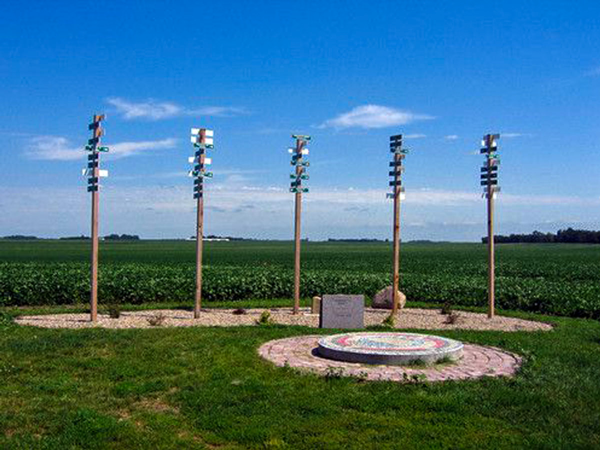
Hawkeye Point is yet another insignificant section of land in the Midwest, but this high point has been turned into a history lesson of the family of farmers that worked that same piece of land for decades. It has been memorialized to not only recognize its height above sea level, but also the family that donated their land to the county for history.
The Sterler family donated their land to Osceola County under the stipulation that it's turned into a public park with the help of the Economic Development Commission and the Hawkeye Point Committee. On top of a kiosk highlighting the Sterler family, the land features the old family farm house, a flagpole, picnic bench, tile mosaic, several granite markers, and five tall posts with signs pointing to the other 49 state highpoints.
While its name makes it sound like it is a mountain, it is by definition not a mountain, yet (again) looks the same as all of the other land around it. It has been marked by a small picnic table, a free mini library, and a sunflower statue made out of railroad spikes.
The peak is located on the private property of Ed and Cindy Harold, who encourage visitors to the site. Where there once was as humorous plaque on the property saying, "On this site in 1897, nothing happened," it was stolen in 2015. We suppose they could erect another sign saying, "On this site in 2015, something happened."
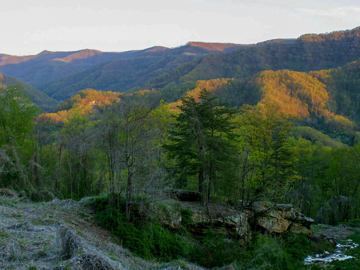
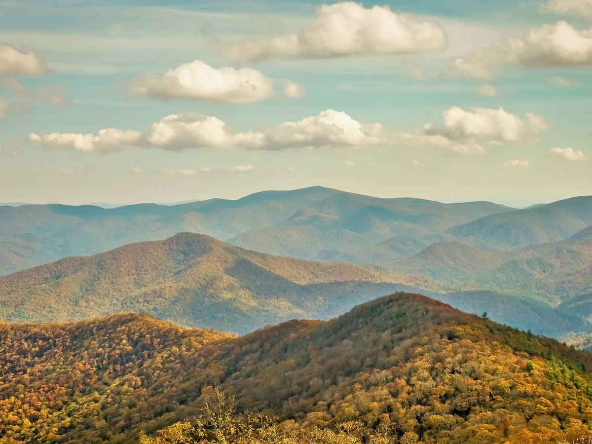
This tallest mountain in Kentucky is on the border the state shares with Virginia. It’s about 500 feet taller than any other mountain in Kentucky and is home to lots of different varieties of wildlife from black bears to red elderberries. In fact, the surrounding small down of 8,000 has been featured on multiple ranked lists.
From “One of the 50 Safest Towns in North Carolina" to “Best Small Town in Western North Carolina" and "Prettiest Small Towns in America to Vacation," we probably don't need to convince you on just how beautiful the views are from this peak. Plus, there's plenty of hiking, walking, biking, camping, fishing, and swimming spots to enjoy.
Although this high point is a lot lower than some in the Midwest, it is also more of a mountain than those high points. At only 535 feet above sea level, Driskill Mountain is essentially a pile of rocks that you can hike to get a peek at the surrounding landscape.
Named after James Christopher Driskill after he purchased the land featuring the mountain in 1859, anyone who traverses the mountain top will experience the gorgeous natural flora, including azalea and dogwood. If you feel like visiting, it likes 5.3 miles from Bryceland and is spotted by the infamous rocks on the high point.
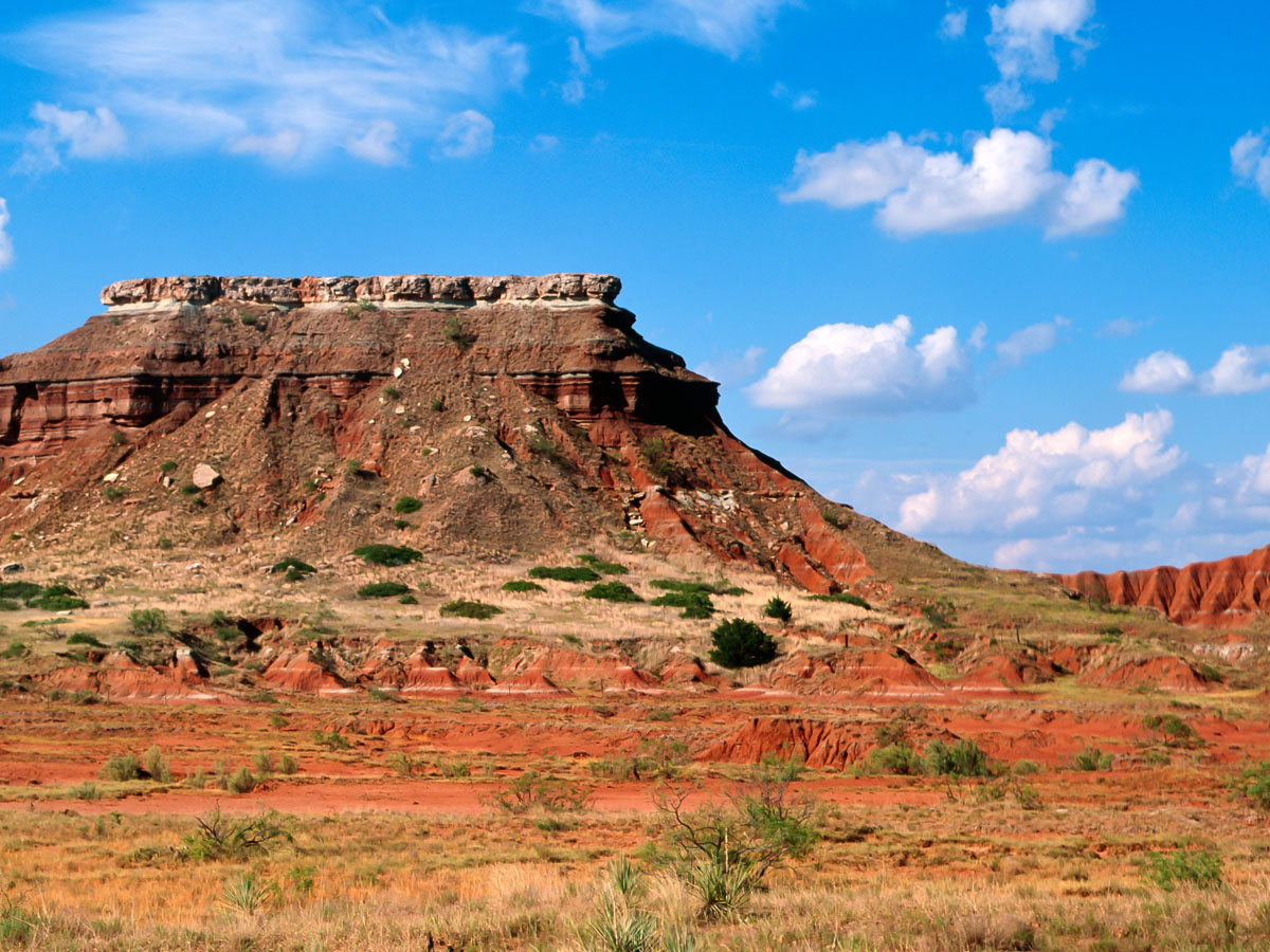
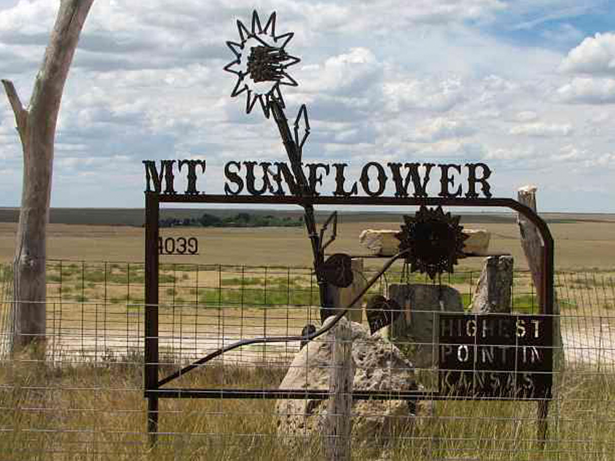
The Black Mesa is known as one of the geological wonders of the United States, and for good reason. It extends from Oklahoma to New Mexico all the way to Colorado. While it is taller at its points in New Mexico and Colorado, it is still the highest point in Oklahoma. However, New Mexico and Colorado have much higher peaks than the ones of Black Mesa.
In fact, the area was a hideout for outlaws in the nineteenth and twentieth centuries. They built a fort called the Robbers' Roost that included a blacksmith shop, gun ports, and a piano without any form of law enforcement. In other news, someone has claimed in the past to have been abducted by aliens at Black Mesa!
While this is a popular destination for people who want to visit all of the highest points in each state, for a while it was basically impossible to visit because the trail to the top was blocked by a piece of land owned by a man who did not like people walking through his property.
His son tried to work out deals where people could visit the top a couple times a year, but the block was eventually lifted after the man’s death and the land ownership transitioned to a different family. The hill is now used for recreation and observation, sporting an observatory for visitors at its peak.
Guadalupe Peak can be found near Texas’s border with New Mexico. It is a very impressive sight as it rises nearly 3,000 feet above the surrounding desert with a sheer cliff. The summit is marked by a stainless steel pyramid that was given to the National Park as a gift.
The pyramid is three-sided to account for the different areas of commemoration. One side features the American Airlines logo, which is the company that donated the structure. Another side features a U.S. Postal Service tribute for the Pony Express Riders, and the third side features a compass and Boy Scouts logo.
Located in southwestern Nevada on the border it shares with California, Boundary Peak stands as the tallest peak in Nevada. However, if state lines were not a thing, Montgomery Peak would be the only star since Boundary Peak is only considered a sub-peak of Montgomery. However, Boundary Peak still gets the victory for the tallest peak in Nevada.
Within the White Mountain range and the Inyo National Forest, Boundary Peak is half a mile from the California state line, which is how the peak got it's name. As for climbing, it's usually accessed from the Nevada side and leads to the ridge connected to Montgomery peak. Contact the U.S. Forest Service for more info on climbing facts and safety at Boundary Peak!
Backbone Mountain is also a part of the Appalachian Mountain range, unsurprisingly. While it is a relatively small mountain, it is still the highest point in Maryland. You can find the Hoye-Crest (the specific point of Maryland's highest elevation), an observation tower, and a colorful crabtree forest on top of Backbone Mountain.
The mountain extends about 40 miles from the southwest to the northeast along the route of the Eastern Continental Divide. Northwest of the mountain are the Youghiogheny River and south of the mountain is the North Branch of the Potomac. Needless to say, there are plenty of landmarks to enjoy around the Backbone.
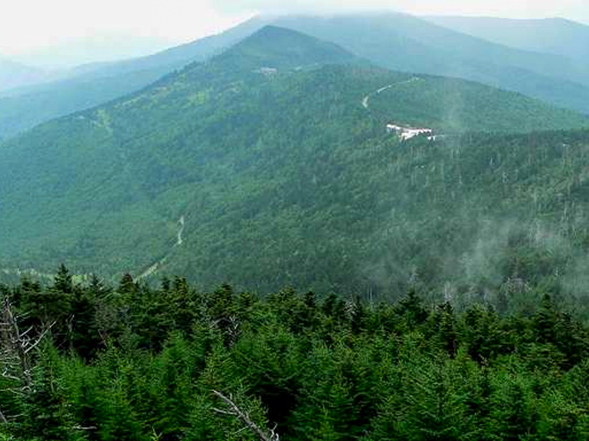
This mountain in Massachusetts was formed as a glacier carved the mountain and helped form the valley surrounding it as well. It also has had a profound impact on American art and literature as Henry David Thoreau, Herman Melville, Nathaniel Hawthorne, and many more drew inspiration for their masterpieces from Mount Greylock.
The Mount Greylock State Reservation features a visitor's center that's open from dawn to dusk daily. After hiking to the peak and looking out at the surroundings, visitors have the potential to see as far as 90 miles away on a day with clear skies. Hiking trails range from beginner to extremely difficult.
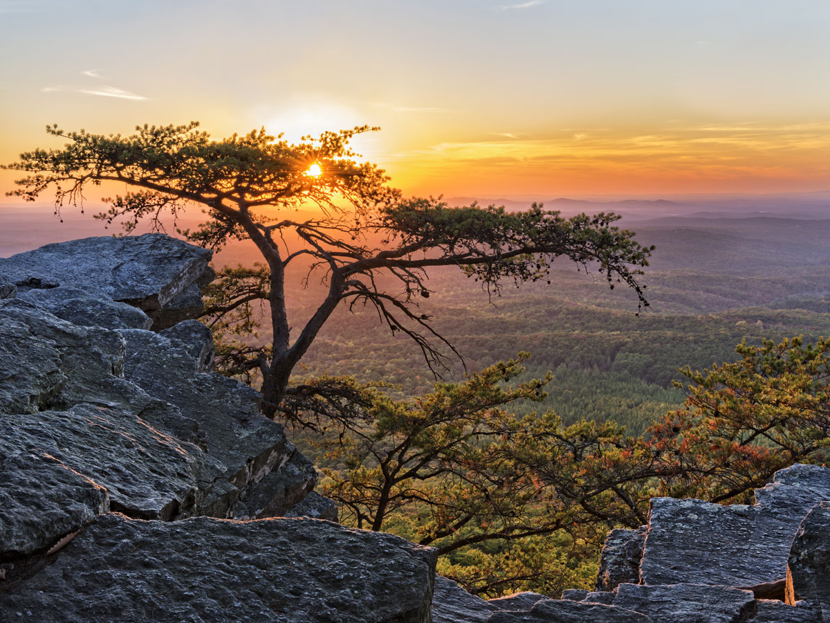
Cheaha Mountain in Alabama is part of the Talladega Mountains, a member of the Blue Ridge Mountains. It’s located in western Alabama and has been a state park since the late 1930s. In Fact, Cheaha Mountain is not only the highest point in Alabama, but quite a few surrounding regions.
This mountain is also the highest point of the Sun Belt, the area east of the Mississippi River, north of the Gulf of Mexico, and south of Interstate 20. So if you're traveling the Southeast for some serious elevation, you won't regret a visit to the big and beautiful Cheaha Mountain.
Although this fact was not discovered until the 1980s, Mount Arvon is the highest point in Michigan. For many years before, it was believed that Mount Curwood, a few miles away from Mount Arvon, was the highest point in Michigan until modern technology proved Mount Arvon taller by one foot.
Fishing, cycling, hiking, waterfalls, lake tours, and heritage sites are only a few opportunities available at the Baraga County Convention & Visitors Bureau. That's not even including the winter attractions! Some annual attractions include the Avron Township Park, the Baraga County Fair in August, and countless campgrounds, trails, and visitor centers.
There are many mountains on this list that are part of the Appalachian Trail, and Mount Rogers is one of them. It got its name from a former student and professor of the College of William and Mary who was the first Virginia State Geologist and founded the Massachusetts Institute of Technology.
This peak is located in the Lewis Fork Wilderness part of Mount Rogers Recreation Area associated with the Jefferson National Forest. Mount Rogers Trail is the most popular hiking and backpacking spot for tourists because it follow the Appalachian Trail, has direct access to the summit, and has the potential to show of the native wild horses.
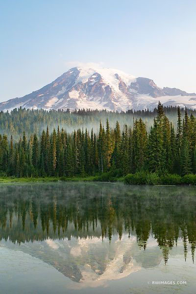
Mount Rainier can be found in western Washington in its namesake Mount Rainier National Park. It is an active volcano and is the highest mountain in the Cascade Range, and it is considered one of the most dangerous volcanoes in the world because of how large and active it is.
Mount Rainer hasn’t erupted since the 1850s, but if it erupts soon, it is predicted to be deadly for millions of people from Vancouver to San Francisco. That's not good! But for the time being, there are plenty of ways to enjoy the mountain for what it is, including winter sports, camping, and technical climbing.
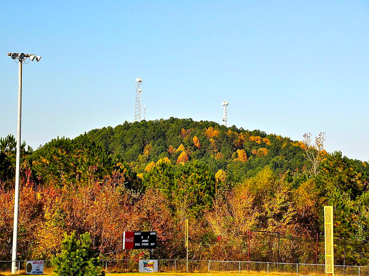
The fact that this hill is named a “mountain” is a joke to the locals as well, don’t worry. They sell shirts that say “Ski Woodall” in nearby shops to poke fun at this “mountain” that rarely sees snowfall. It is quite a bit taller than the surrounding land, however, and because of that was an important spot in the Battle of Iuka during the Civil War.
Not much is featured at the top of the hill except for a bench, a high point register, and a gravel circle for parking. A wooden observation tower was built in the 20th century in the middle of the parking circle, but it quickly deteriorated from incessant rotting and was subsequently torn down in 1998.
Much like Charles Mound in Illinois, Hoosier Hill Point in Indiana is nothing special when you look at it. It just looks like another hill in the middle of the rolling farmland—except that this high point is in the middle of a small forest area surrounded by the rolling farmland.
At least it has been made into a small park, though, so it can be recognized by a small monument instead of an underwhelming mound. This point is also located on private property, so it took the work of Eagle Scout Kyle Cummings to build the a trail, sign, and picnic area for the humble peak.
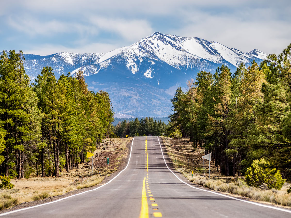
Humphreys Peak in central Arizona is proof that Arizona is not all flat desert. This peak is very commonly covered in snow and part of the Kachina Peaks Wilderness. Located in Coconino County, Humphreys Peak is the highest natural point in Arizona at an impressive elevation of 12,633 feet.
Fun fact, this peak got its name from the Civil War general Andrew Atkinson Humphreys who led Union troops at Gettysburg. Also, did you know that is actually part of a group of dormant volcanoes? The San Francisco Volcanic Field lies within Coconino and Kaibab National Forests and has produced over 600 volcanoes in the past six million years!
While it may not be as impressive as the previous two mentioned, Mount Frissell is still the tallest peak in Connecticut. It sits on the border of Massachusetts and Connecticut as part of the Taconic Range, and Connecticut gets to claim this peak because it falls within their state line.
Mount Frissell, like most any mountain, is a popular hiking destination for both experienced and novice climbers. Most people access the mountain from the Mount Frissel Trail connected to the South Taconic Trail from the west and the Appalachian Trail from the east. To reach the peak, climbers opt for starting at an elevation of 1,800 feet between Frissell and Bear Mountain.
While this name and the high elevation make you think that this peak is on top of a mountain that overlooks everything around it, you would be wrong. This is actually a pretty insignificant looking spot in the middle of the plains which is so flat you can see all around you for what seems like miles in panoramic view.
Also referred to as Constable Mountain, Panorama Point doesn't have much to its name besides a stone marker signaling the elevation and a guest register at the summit. As for the view, visitors can see the nearby state corner sign, vast plains, and a chance to glimpse the ranging bison.
Spruce Knob is the highest point of Spruce Mountain in West Virginia and is classified as the highest point in the state of West Virginia. Its environment is very alpine-esque, which is not common for the mountains found in this region. This is because of the dense forest of Spruce trees that give this mountain and peak their name.
Spruce Knob is part of the Allegheny Mountains and is known for its "whale-backed" ridge extending over 4,500 feet high but only 16 miles long. Spruce Knob-Seneca Rocks National Recreation Area within the Monongahela National Forest is over 100,000 acres of land protect by the U.S. Forest Service and used by visitors for camping and hiking.
High Point is a small mountain peak in New Jersey that lies in High Point State Park. Although it is small, it is still the highest in its range. It is marked with a 220 foot tall war memorial monument that allows visitors to look across the surrounding area for miles.
Where the state park is located, the land was landscaped by the sons of the man who designed Central Park in New York. The peak features High Point Monument, an obelisk built in 1930 as a memorial for war veterans. The trails are great for cross-country skiing in the winter and scenic views year round!
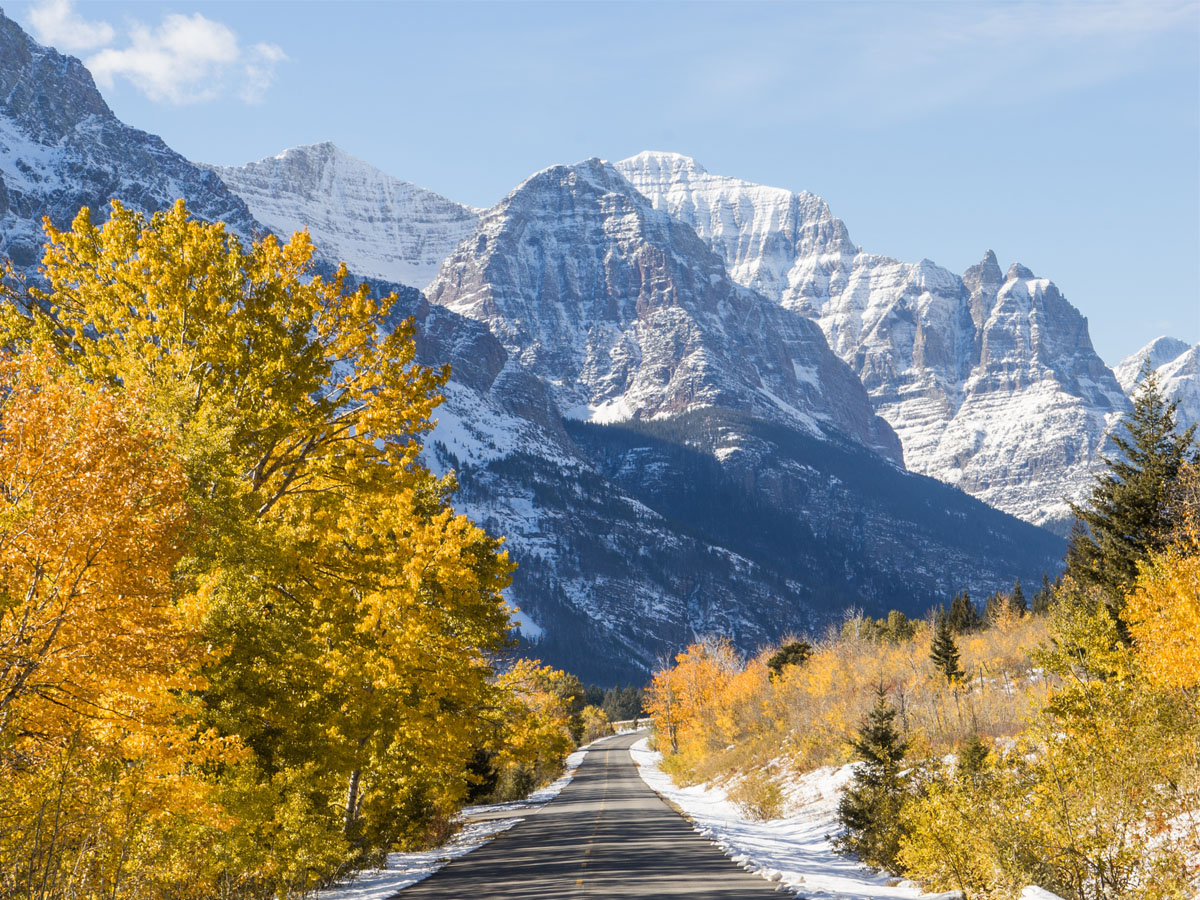
Wheeler Peak is a popular hiking destination in New Mexico. It stands at over 13,000 feet tall and is the tallest of the peaks along its trail (and in the state, obviously). It is part of the Wheeler Peak Wilderness area and Carson National Forest for a natural weekend getaway.
This peak is northeast of Taos, south of the Red River, and 2 miles southeast of the Taos Ski Valley ski slopes in the Sangre de Cristo Mountains of the Rocky Mountains. A commemorative plaque stands on the site explaining the name's origin: "Named in honor of Major George Montague Wheeler (1832–1909) who for ten years led a party of surveyors and naturalists collecting geologic, biologic, planimetric and topographic data in New Mexico and six other southwestern states."
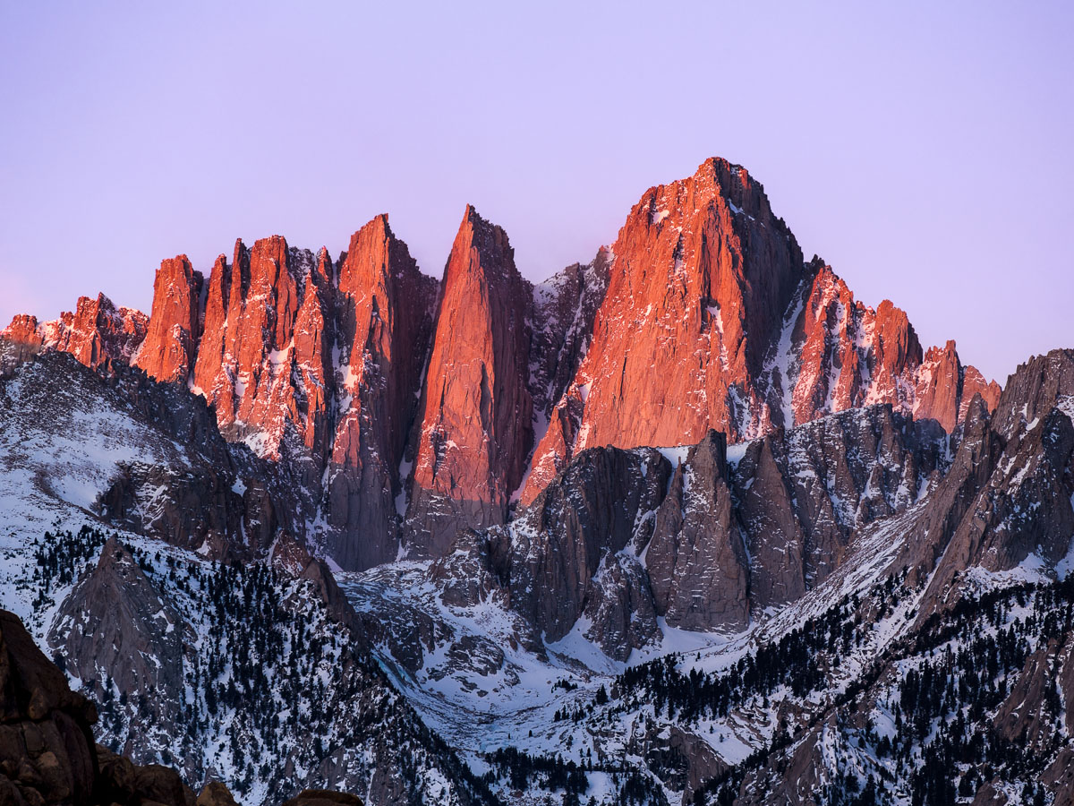
Mount Whitney is the tallest mountain in the contiguous United States. It lies in Sierra Nevada near southern California, so it is very close to Sequoia National Park. If you are making a trip to climb Mount Whitney, you might want to also plan a visit to both gorgeous locations!
Just because Mount Whitney isn't the U.S.'s or the world's tallest peak doesn't mean it should be underestimated. The Mt. Whitney trail is extremely difficult, especially if you're planning on a day hike. The 20-mile-long trail features around 7,000 feet of elevation, which is a monumental task for untrained hikers.
It is said that when viewed from the east, Mount Mansfield looks like it is a super stretched out profile of a person’s face. Frequenters of the mountain refer to its peaks as the nose and chin, because those are the highest points on this mountain. It is also home to one of the few remaining true alpine tundras still remaining from the Ice Age.
Because of the historic tundra, Mount Mansfield is routinely used for hiking and skiing. Located in Mount Mansfield Stae Forest, the Long Trail is a popular hiking trail for visitors as well as expert trails including the "Front Four." Some cross-country ski trails include the Bruce Trail and the Teardrop Trail associated with nearby resorts.
While Campbell Hill does not look that impressive, it is still not the smallest high point in the U.S., ranking the 43rd highest point in the U.S. for each state. It is designated by a well-manicured park that used to be the home of an Air Force station during the Cold War.
The Air Force base has since been replaced by the Ohio Hi-Point Career Center open on weekdays. Apparently, Campbell Hill is scientifically classified as a glacial moraine and is referred to as "the most manicured of the state highpoints." Some recreational activities include downhill skiing, the nearby Zane Shawnee Caverns, and the headwaters of the Mad River of Ohio.
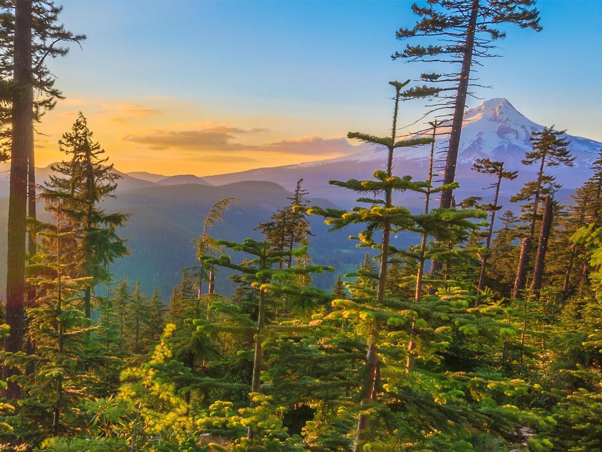
Mount Hood is a potentially active volcano in northern Oregon. The last time it erupted was well over 150 years ago, and there is a potential for another eruption in the next 30 years. The most recent activity, however, has been earthquakes and the formation of hot springs. It is also home to glaciers and snowfields.
Because Mount Hood is one of the loftiest American mountains, it has a popular skiing scene. In fact, it offers the only year-round lift-served skiing in North America! The six associated ski areas total almost 5,000 acres of accessible terrain. Also within the Mount Hood National Forest are designated hiking trails for the less winter-inclined visitors.
Mount Davis is a subtle mountain in Pennsylvania that has been recognized as the highest point in the state since 1921. Before that calculation, it was believed that Blue Knob in Bedford County was the highest point in the state. It is marked with an observation tower and used to house a small cabin.
Mount Davis is located in Forbes State Park, which is home to nine accessible, named trails for hiking and recreation. It was named after early American settler and Civil War veteran John Nelson Davis for his work as a surveyor and naturalist, which led him to record the mountain's native flora and fauna.
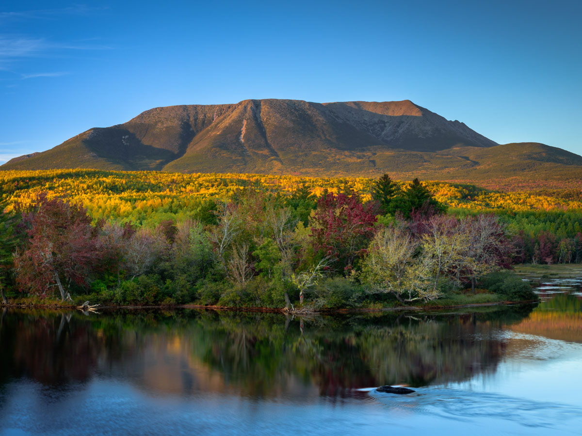
Mount Katahdin is a member of the Appalachian Mountains. It is protected as a National Natural Landmark by the National Park Service at the center of Baxter State Park. It got its name from the Penobscot Native Americans meaning “The Greatest Mountain" and features the natural flora and fauna of New England.
From the black bear to the moose and the Arctic butterfly, Mount Katahdin has plenty to enjoy. Popular for its hiking and backpacking opportunities, the trails are associated with the Appalachain Trail and the International Appalachian Trail. Open year round and used regularly, the trails range from moderate to strenuous, but Baxter State Park has limited capacity for certain trails to prevent overuse.
Another member of the Appalachian Mountains that is considered the highest point in its state is Sassafras Mountain in South Carolina. Like many of the other high points, this one has an observation tower and deck, but this one is wheelchair accessible because of its ramp, so more people get to enjoy the views.
But we all have to be wondering about the origin of its hilarious name. It actually has a pretty straightforward origin. The name results form the abundant presence of sassafras trees on its low slopes. Go figure! The mountain is also home to Henderson Gneiss, a combination of quartz, muscovite, and feldspar.
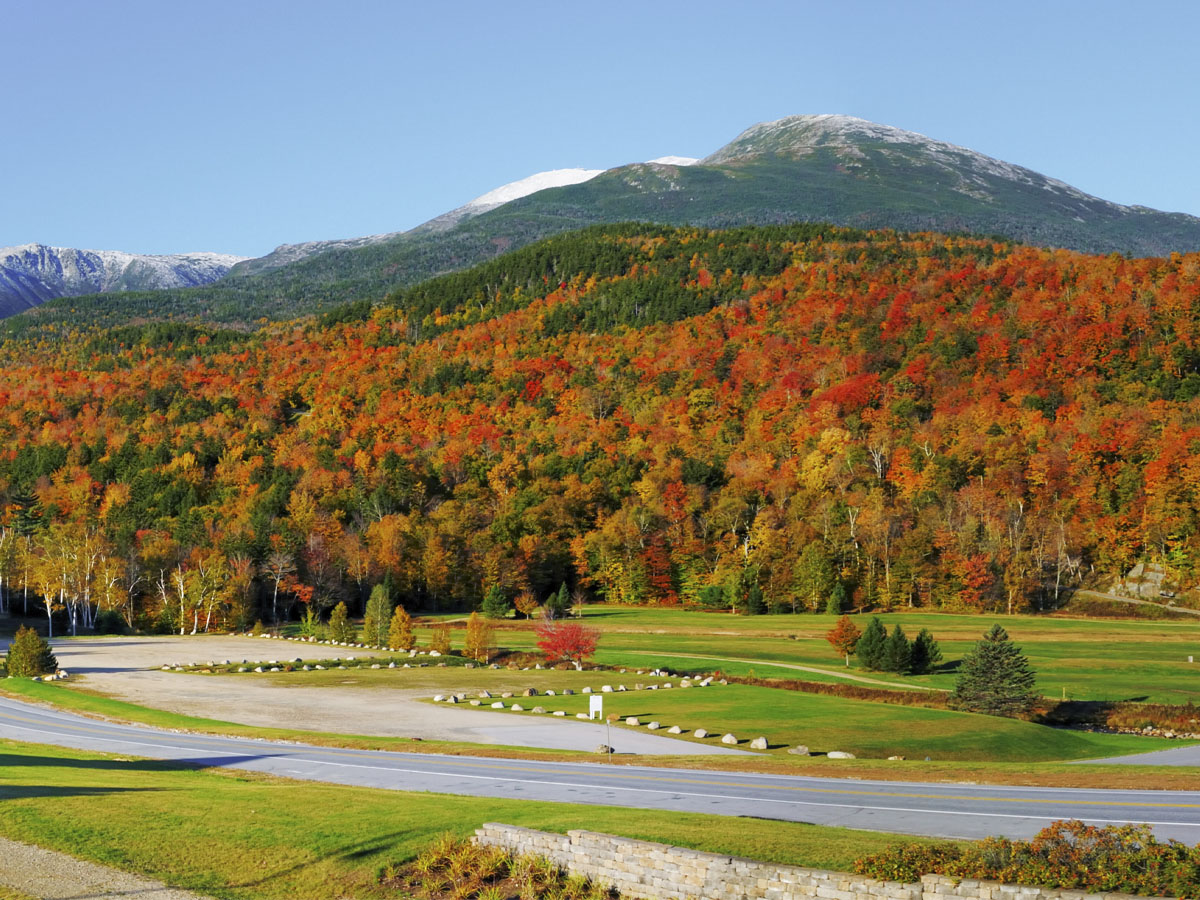
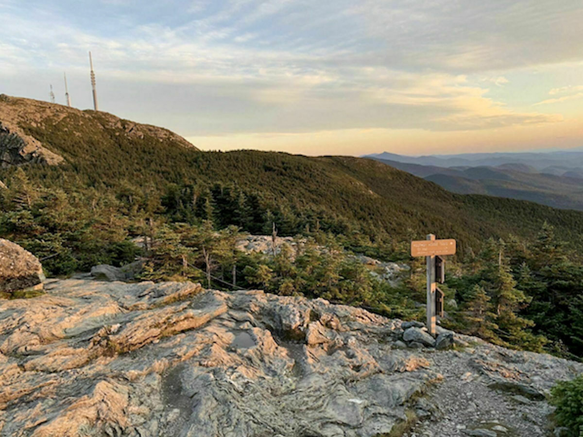
Mount Washington is a snow-capped mountain known for its crazy weather, and it’s also a popular recreational destination for many hikers, bikers, runners, and tourists. It holds the record for the highest measured wind speed not associated with a tornado or tropical storm from a measurement that was taken in 1934.
Also, it held the record for highest measured wind speed, period, until 1996! And for another fun fact, Mount Washington is called Agiocochook by some Native American tribes and located in the Presidential Range (get it?) of the White Mountains. Popular activities include hiking on the Appalachian Trial, glider flying, backcountry skiing, cycling, and running.
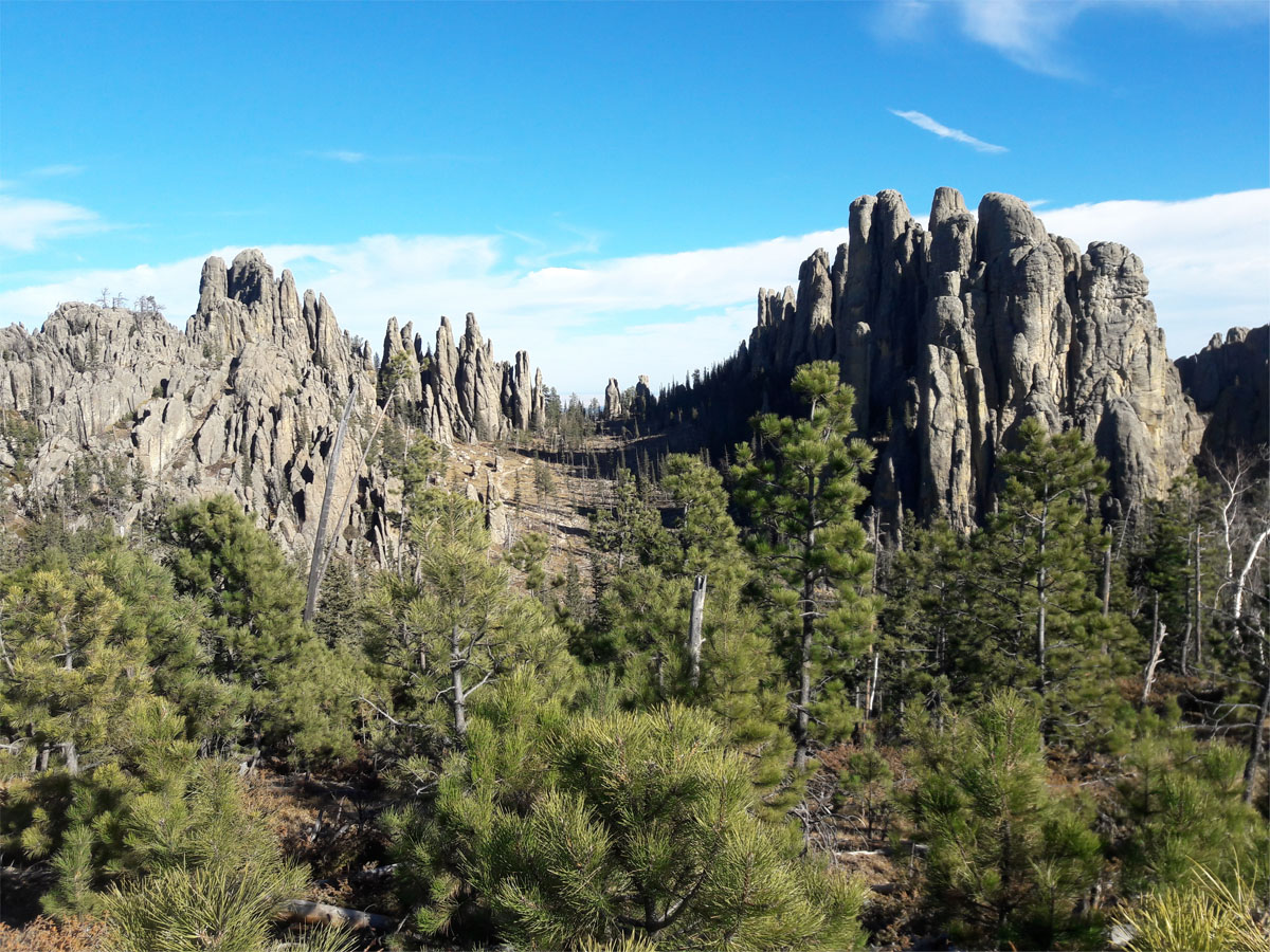
Formerly Harney Peak, this peak is now known as Black Elk Peak in English to recognize the Lakota people’s original name for it which translates to “black elk.” The Lakota have another name for it as well which means “owl-maker” because the rock formations look like owls frozen in time.
While it is categorized as a hill, it is still a very impressive structure that looks pretty cool and is a sacred spot to the Lakota people in the Black Hills. There are hiking trails associated with the mountain, but a permit is required for the second half of the Sylvan Lake trailhead in Custer State Park. At the summit is an old stone fire lookout tower and a commemorative plaque.
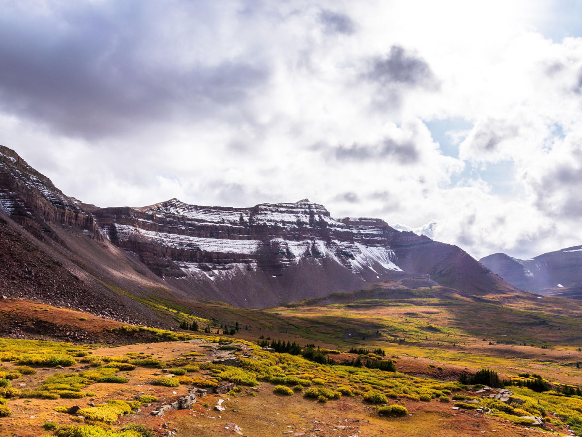
You might want to think twice before deciding to climb Kings Peak. It is considered the hardest high point in the United States to reach, even with professional climbing experience and equipment. It was named after Charles King, the first director of the United States Geological Survey, which is responsible for the majority of the measurements in this list.
Kings Peak is located in the Uinta Mountains and the Ashley National Forest east of Salt Lake City. The most popular use of the peak is for recreational hiking. There are three routes that are typically chosen with a range of difficulties. The southern slope trail is considered relatively easy, but the east and northern slopes are not for the faint-hearted.
This high point in North Dakota is actually on private land. It is owned by a local family who requests donations from visitors and hikers to maintain the area. This "butte," an isolated hill with steep sides and a flat top, is in the North Dakota Badlands, and is quite prominent in the landscape.
The summit is positioned between the Little Missouri National Grassland and south of Theodore Roosevelt National Park if you're looking to visit a park with scenic drives and catered attractions. The White Butte itself is visitied for hiking. The trail itself is a 4-mile round trip starting from the trailhead.

While Eagle Mountain is technically just a really big hill, like a few of the previous "peaks," it stands at about 2,301 feet above sea level and directly contrasts with Minnesota’s lowest point, Lake Superior, because they are neighbors. There is about a 1,500 foot difference in elevation between the two.
Located in northern Cook County, it's featured in the Boundary Waters Canoe Area Wilderness and Superior National Forest in the Misquah Hills as a Minnesota State Historic Site. If you're interested in hiking to the peak, the trip can be made in about two-and-a-half hours, plenty of time to enjoy Lake Superior in the same day. Make sure you're experienced enough to master the rocky trail and have all the proper permits!
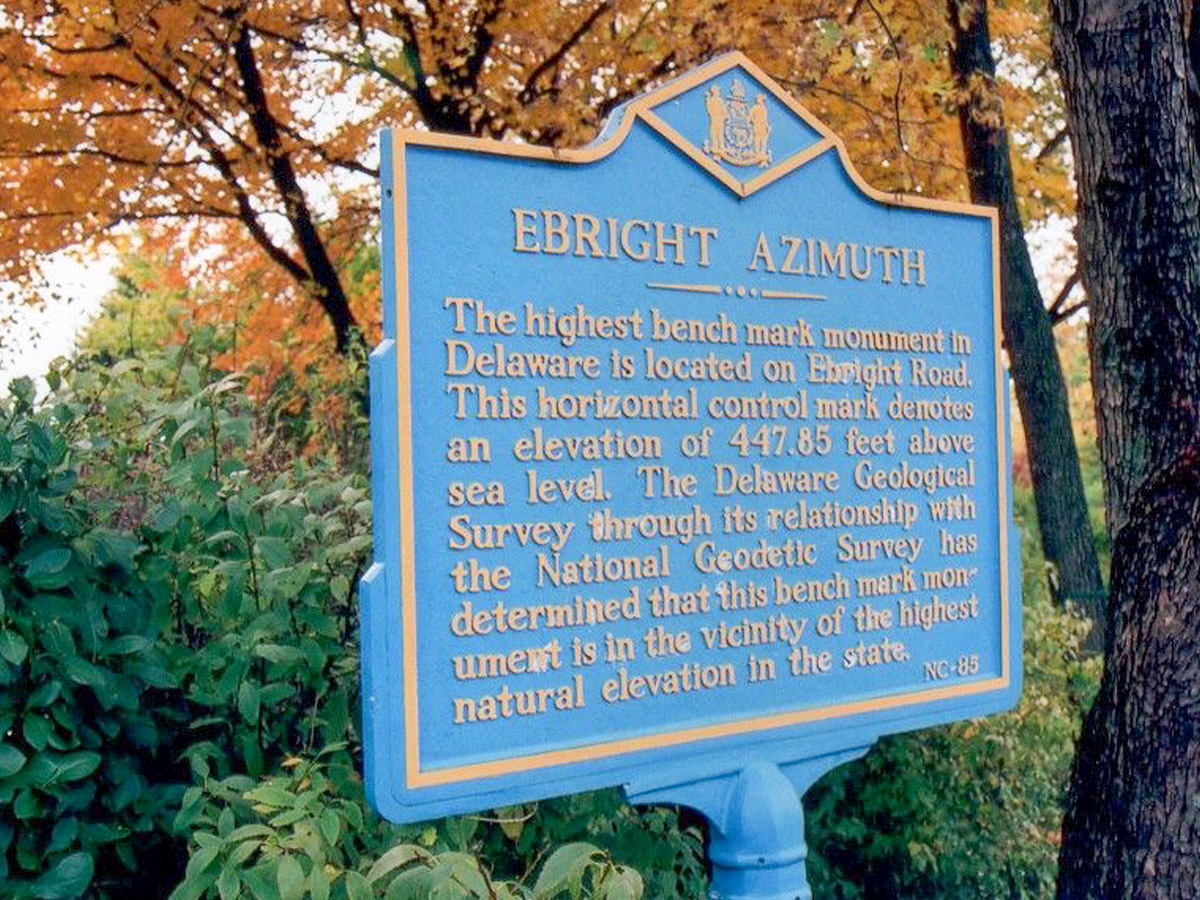
With a pretty comical name and equally funny appearance, you wouldn’t even know you were at the highest point in Delaware even if you were looking at the sign marker. Along the side of a road next to a bench is the sign that claims this spot as the highest point in Delaware at 448 feet above sea level.
There's only one other U.S. peak that's lower in elevation than Ebright Azimuth, which we'll be addressing shortly. As for now, how about a history lesson? Ebright Azimuth is named after the former owners of the property, James and Grant Ebright. The odd name originated from the angular measurement called the azimuth, which combined with the Ebright name forms the peaks title.
Timms Hill is simply a hill in north-central Wisconsin that just so happens to be the highest point in the state. The top of the hill has a public lookout tower, and the Timms Hill trail that runs by it is part of the Ice Age Trail, a very long trail that tracks along ancient routes of glaciers.
Timms Hill is located in Timms Hill County Park, which includes the aforementioned public lookout tower at the summit and the 1,2000 mile -public hiking trail. At the tower, visitors can enjoy views of Rib Mountain to the southeast and follow the associated hiking trails across the glacial terrain.
This mountain in New York is best known for its nearby lake that is said to be the start of the popular and historical Hudson River. Mount Marcy was also where then-Vice President Teddy Roosevelt was when he heard that President McKinley had died, and he would become the next President. He hiked down the mountain, took a train to Buffalo, and was sworn in as President.
Mount Marcy is the tallest peak of the High Peaks in the Adirondack Mountains and is commemorated by two plaques at the summit regarding its height as well as the first dated climb of the mountain. At this location, visitors have a chance to view the distant Moneregrian Hills volcano chain. Much of the trail can be used for alpine skiing and snowboarding.
Last but not least is Gannett Peak! Gannett Peak is the tallest mountain in the Rockies outside of Colorado and is also part of the Greater Yellowstone Ecosystem. The Gannett Glacier, which covers part of the mountain, is also noted as the largest singular glacier in the American Rocky Mountains.
Along with Denali and Granite Peak, Gannett Peak is one of the most difficult state high points to reach. But don’t worry, the one in Florida is a literal walk in the park if you want something a little (or a lot) more low-key. We don't exactly recommend Gannett to the causal hiker given the bears, wildfires, freezing nighttime temperatures, and history of notable hiking accidents.